Why in the News?
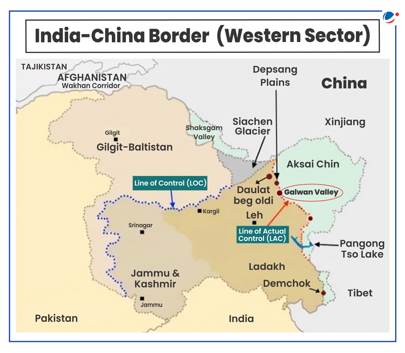
Recently, India and China agreed for disengagement and resume patrolling in the Depsang Plains and Demchok areas along the Line of Actual Control (LAC), as it was before the tensions in May 2020.
More on the News
- Under the current agreement, Indian and Chinese soldiers will return to patrolling along the LAC in the same manner as before the border tensions erupted in May 2020.
- Dis-engagement in other areas of friction that erupted post 2020 in eastern Ladakh i.e. Galwan, Hot Springs, Gogra, north and south banks of Pangong Tso had already completed.
- The agreement marks the first step of a three-step process – disengagement, de-escalation and de-induction of troops on the India-China border areas.
- The agreement is also significant because Depsang Plains are strategically important as they lie 30 km southeast of the Daulat Beg Oldie post near the Karakoram Pass and offer a flat terrain suitable for launching military offensives, similar to the Spanggur Gap in Chushul.
 About 2020 India-China Stand off
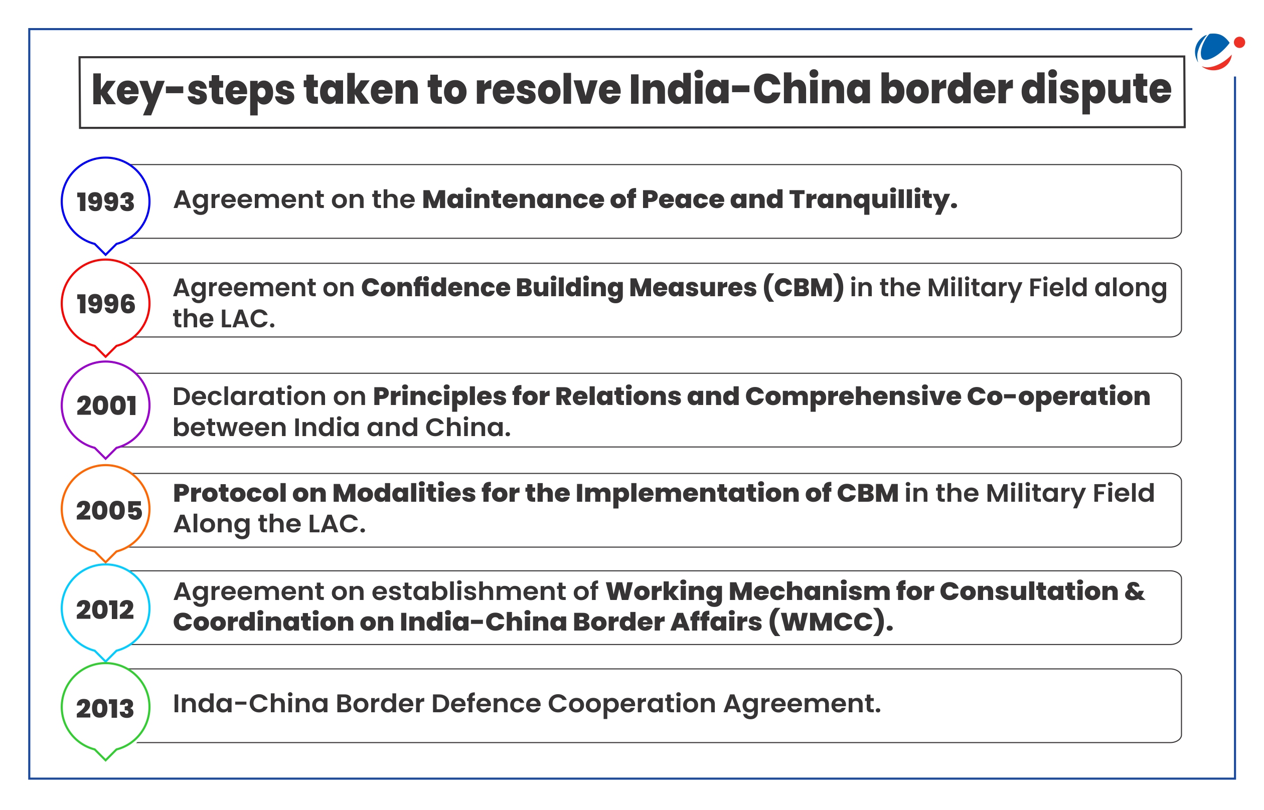
|
India-China Border Dispute
The 3,488-km border is not clearly demarcated throughout and there is no mutually agreed Line of Actual Control (LAC) along certain stretches.
- LAC that came into existence after the 1962 India-China war is the demarcation that separates Indian-controlled territory from Chinese-controlled territory.
- India considers the LAC to be 3,488 km long, while the Chinese consider it to be only around 2,000 km.
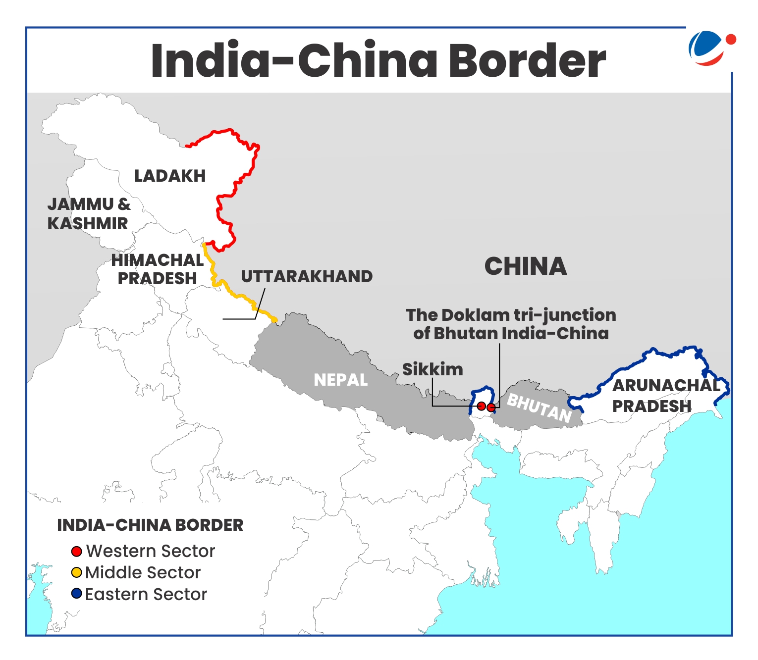
India–China boundary is divided into three sectors:
- Western sector (Ladakh): Boundary dispute in this sector pertains to the Johnson Line proposed by the British in the 1860s that put Aksai Chin in the then princely state of Jammu and Kashmir.
- China, however, does not recognise Johnson Line and their claim is based on McDonald Line (of 1890s) which puts Aksai Chin under its control.
- Middle sector (Uttarakhand and Himachal Pradesh): Largely undisputed area. It is the only sector where India and China have exchanged maps on which they broadly agree, despite no formal demarcation of boundaries.
- Eastern Sector (Arunachal Pradesh and Sikkim): Disputed boundary in this sector is over the McMahon Line (in Arunachal Pradesh) decided in 1914 Simla Convention with representatives of China, British India, and Tibet in Shimla.
- China rejects MacMahon line and claims entire Arunachal Pradesh as part of Tibet Autonomous Region.
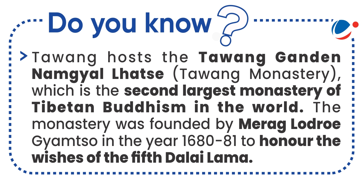
- China cites historical ties between the Tawang monastery and Tibet's Lhasa monastery to bolster its claims over Arunachal Pradesh.

Other areas of concerns in India-China relations
|
Reasons for China's assertiveness along LAC
- India's Strategic Autonomy and rising global footprint
- India as economic and military power: China is wary of India's economic and military rise and recent status as the world's most populous country.
- For India, a hot border means the diversion of even greater resources for frontier defense, making it difficult for India to focus not only on its broader strategic competition with China, but will also further strengthen China-Pakistan alliance.
- Rejection of BRI: India is the only country in South Asia to opt out of China's BRI program launched in 2013.
- India as a regional democratic power: India presents a sustainable alternative to China's debt-trap policy for neighbouring countries, challenging China's influence. For example,
- Maldives, under President Mohamed Muizzu, who previously championed 'India Out' campaign announced adoption of vision for Comprehensive Economic and Maritime Security Partnership with India.
- India has also championed for raising the 'Voice of Global South' in different global forums and multilateral institutions like the IMF and the UNSC.
- India as economic and military power: China is wary of India's economic and military rise and recent status as the world's most populous country.

- The Bhutan factor: If China gains control of Arunachal, it would mean that the kingdom of Bhutan would have China as its neighbour on both the western and eastern borders which could give its military a huge advantage.
- China has proposed to "swap" areas in Doklam under Bhutanese control with areas in Jakarlung and Pasamlung which China claims.
- Doklam trijunction (between Bhutan, India and China) cuts very close to India's Siliguri corridor (Chicken's neck) a narrow area connecting the North Eastern States to the rest of India. China's efforts to move closer to the Siliguri corridor is a security threat for both India and Bhutan.
- Arunachal Pradesh's Strategic Importance
- Strategic location: Arunachal Pradesh is the closest location for India to target China with missiles. Also, Arunachal is the best location for India to deploy a multi-layered air defence system for possible attacks from China.
- It also provides China a strategic entry into India's northeastern region.
- Tibet Factor: Tawang of Arunachal Pradesh is an important center of Tibetan Buddhism. There are some tribes in the upper Arunachal region which have cultural connections to the people of Tibet.
- China fears that the presence of these ethnic groups in Arunachal could at some stage give rise to a pro-democracy Tibetan movement against Beijing.
- Ideological and changing global dynamics
- Chinese Middle Kingdom Complex or Sinocentrism: The contemporary foreign policy of Chinese President Xi Jinping is said to be motivated by Middle Kingdom Complex or Sinocentrism.
- Sinocentrism is an ethnocentric political ideology that regards China as the civilized centre of the world, surrounded by barbarians and savages.
- Some commentators view the Chinese BRI as part of the sinocentric world-view of China which, in turn, is a challenge to the Western liberal economic order and India's status in Asia.
- India's bonhomie with democratic powers: India's participation in alliances like the Quad with the U.S., Japan, and Australia strengthens its counterbalance to China, making China wary of India's rise.
- 'Grey Zone' warfare: It is the area between peace and war. It involves use of unconventional tactics and strategies that fall below the threshold of traditional warfare.
- It aims to harm an adversary without them feeling threatened or realizing they are under attack.
- Example, 'Salami Slicing' Strategy that involves taking over territory in a very gradual manner. It has been allegedly used by China for territorial expansion in the South China Sea.
- Chinese Middle Kingdom Complex or Sinocentrism: The contemporary foreign policy of Chinese President Xi Jinping is said to be motivated by Middle Kingdom Complex or Sinocentrism.

Conclusion
Going forward, in the words of India's Minister of External Affairs, 'the relationship between India and China is "quite a challenge" since India and China are the two most populous countries of the world, both rising in a broadly parallel timeframe, physically next to each other'.
The relationship was profoundly affected by 2020 military standoff as it has always been an assumption by India that peace and tranquility in the border areas is a prerequisite for the development of bilateral ties. Both countries will also have to look at it slowly and progressively.


