News Today Logo

Posted 27 Aug 2024

1 min read

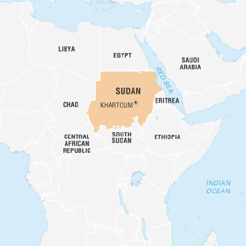
A map of Northeast Africa highlighting Sudan in orange. Sudan is bordered by Egypt to the north, the Red Sea, and Eritrea to the east, Ethiopia to the southeast, South Sudan to the south, Central African Republic to the southwest, Chad to the west, and Libya to the northwest. The capital, Khartoum, is marked with a star.

Sudan (Capital: Khartoum)

Dam collapses in eastern Sudan after heavy rainfall claims multiple lives.

Political features 

  • Land Borders: by Egypt (north), Eritrea and Ethiopia (east), South Sudan (south), Central African Republic and Chad (west), and Libya (northwest).
  • Maritime Border: Red Sea (east).

Geographical features

  • Highest point:  Deriba Caldera (Crater Lake) at Jebel Mara.
  • Major Rivers: Nile, Tekeze etc.
  • Climate: Varies from north to south. Northern part is a desert climate, receiving little rainfall, shifting to semi-arid and then tropical savannah towards south. 
  • Tags :
  • Sudan
  • Khartoum
  • Nile
  • Deriba Caldera
Watch News Today
Width resize handle
Height resize handle

Search Notes

Filter Notes

No notes yet

Create your first note to get started.

No notes found

Try adjusting your search criteria.

Subscribe for Premium Features